PhD Thesis: Mesh-based Shape Approximation with Guaranteed Progress Toward Global Optima
See topic on this page: https://team.inria.fr/titane/files/2025/05/phd-topic.pdf


See topic on this page: https://team.inria.fr/titane/files/2025/05/phd-topic.pdf

Inria Senior ResearcherTeam LeaderPresident of the Inria Evaluation CommissionScientific coordinator of the Inria-DFKI partnership3IA Côte d’Azur ChairProject-team TITANEInria Sophia Antipolis – Méditerranée Contact informationPierre AlliezInria Sophia-Antipolis2004 route des Lucioles BP 9306902 Sophia-Antipolis cedexFRANCEOffice: Y313 (Byron building)Phone: (33) 4 92 38 76 77Email: pierre.alliez (replace by arobas) inria.fr My main research interests…
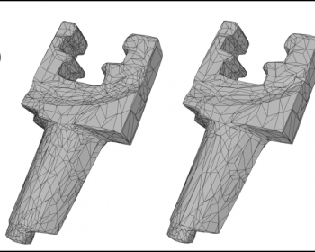
Slides: 1.1 Getting started 1.2 Mesh generation Labs on 2D and 3D meshing (unzip and read todo files) : link Point sets : link Meshes : link
November 10, at 14:15 in room Byron blanc (downstairs) In this talk, we introduce a full geometric parameterization of generalized barycentric coordinates on convex polytopes. We show that these continuous and non-negative coefficients ensuring linear precision can be efficiently and exactly computed through a power diagram of the polytope’s vertices…
Abstract: Countless techniques in geometry processing can be described variationally, that is, as the minimization or maximization of an objective function measuring shape properties. Algorithms for parameterization, mapping, quad meshing, alignment, smoothing, and other tasks can be expressed and solved in this powerful language. With this motivation in mind, this…
joint work with Manish Mandad, David Cohen-Steiner, Mathieu Desbrun and Leif Kobbelt. Recent advances based on entropic regularization are unleashing the power of optimal transport. In this talk I will present a novel approach for computing a homeomorphic map between two discrete surfaces. While most previous approaches compose maps over…
Abstract:. In this talk, I will present our recent results related to aligning and analyzing data sequences consisting of 3D frames that capture a surface undergoing a motion. We focus on the motion of human body and face shapes, which are especially important in various applications including tele-presence and design…
Abstract: Vector drawing is a popular representation in graphic design because of the precision, compactness and editability offered by parametric curves. However, prior work on line drawing vectorization focused solely on faithfully capturing input bitmaps, and largely overlooked the problem of producing a compact and editable curve network. As a…
Title: Towards large-scale city reconstruction from satellites Abstract: Automatic city modeling from satellite imagery is one of the biggest challenges in urban reconstruction. Existing methods produce at best rough and dense Digital Surface Models. Inspired by recent works on semantic 3D reconstruction and region-based stereovision, we propose a method for producing compact, semantic-aware and geometrically…